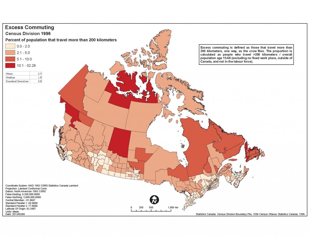
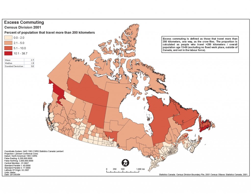
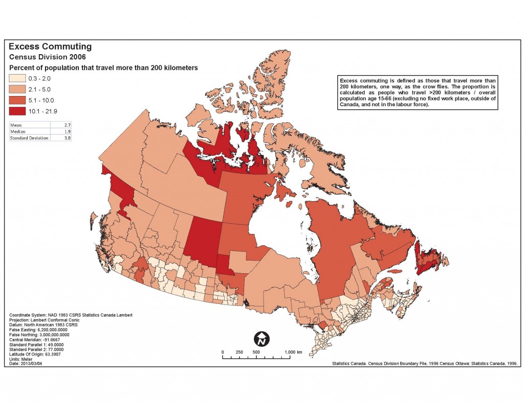
The maps below have been generated by On the Move’s Statistics Component to provide a snapshot view of what the Canada Census of 1996, 2001 and 2006 can tell us about long distance commuting.
NOTE: Commuting distance may be inflated for persons who work outside the areas covered by census metropolitan areas or census agglomerations, since the workplace location is usually coded to a single representative point for the census subdivision of work. This can affect the calculated commuting distance, particularly when the census subdivision of work has a large area.
Commuting distance: This variable is only applicable for those individuals that have a usual place of work. It is calculated using the straight line distance between the residential area representative point and the workplace location representative point.
Click each map for a larger view.

Maps created by Reid McLean, C-Zone Consulting.
Top ^


